Showing posts with label war memorial. Show all posts

Friday, 25 March 2016

A visit to Maisonnais-sur-Tardoire

Maisonnais-sur-Tardoire is a commune of about 400 inhabitants, in the Haute-Vienne department, but only 20 minutes by car to the east of here.

Located on the ancient Roman road from Perigueux to Poitiers, the area has been inhabited since time immemorial! Underground silos (cluzeaux) used for crop storage, dating from the Merovingian period (when the Romans and Gauls held sway over France in the 5th - 8th centuries) have been discovered nearby. 

The honey produced in the commune has the label "Regional Natural Périgord Limousin" and they have a notable honey festival to celebrate, attended by many beekeepers on the third weekend in September.
A view down the main street approaching the church. It's such a well-kept village!! The first thing  one notices is the exceptional state of the buildings, even including the barns!; the stonework, mortar, painting, roof tiling and carpentry are all exquisitely restored, maintained and preserved!

The village church is dedicated to Saint-Cyprian. It was built in the 11th century in the Romanesque style and its square steeple is somewhat unusual.

The simple altar. Note too that domed stone vaulted ceiling, curved in two directions! How skillful is that, with 11 century building techniques!

The pulpit, obviously a later addition, but a plain design, in keeping with the original structure.

We visited the village to hear a concert by a local choir, of which a friend is a member. They learn and sing songs from countries all around the world.The list of songs they sang, if you should be interested, is at the end of this post.The singing was excellent, and in fact so well appreciated by the audience they did two encores!

Elaborate dovecote-porch entrance to the large house opposite the church.

The property also has a second gateway (the servant's entrance?) on the other side!

 Looking down the immaculate main street, away from the church, note the house on the right. It's unusual, but it's not immediately obvious why this is so......

 here it is again, from the other side.
It was built in 1905, not using the normal local granite, but using limestone from the Charente.See how the corners and frames to openings are carefully detailed in squared stone blocks. Expensive! Its mansard roof with dormer windows is a design feature generally found in much grander residences.Many of the other village houses are rendered (this was a fashion in times past, to show one's neighbours that one had  the money to spend to upgrade one's house!) but this building really outdid all the neighbours! In 1910, the building was the local post office, but whether it was originally built as such isn't stated. Thankfully no-one has interfered with the original mason's fine craftsmanship and it remains unaltered to this day.


The entrance and window. More very expensive carving. This building is quite a statement of expense in a small country farming village. One wonders what the inhabitants at the time made of this lavishness!

Detail of the stone carving over the window.

The local Mairie (Mayor's office), the bus stop, and  not forgetting the lady in black, of whom every French village has at least one!

and of course no village in France would be complete without a war memorial. To close, as promised, the concert programme!


Also see my daily diary HERE

and My Life Before Charente (updated 08 February 2016) 

Saturday, 14 November 2015

Thiepval Memorial and Anglo-French cemetery.

We visited the Thiepval Memorial in northern France in May as part of a visit to WW1 battle sites, at this centenary time, to see where so, so many, soldiers from all parts of the world, including our relatives, had fought and died. Thiepval is a small village in the beautiful Picardy region and it lies in the valley of the river Somme, scene of fierce battles for control of the area.

This information sign below is displayed at the site and sets out, as well as anyone could, the motivation for the memorial and how it came to be built.


Amongst these 72,000 names are seven holders of the Victoria Cross (one a South African) and numerous sportsmen of the time; top cricket and rugby players from all parts of the United Kingdom.

During construction. This memorial is probably the most imposing of such British structures in the area and is visited by 120,000 people every year. The white panels are of Portland stone from Dorset and the brick above was from Lille, the nearby French town.

Another view of the memorial later in its construction. It is 43 metres (140 feet) high and is built on very thick foundations, required because of wartime tunnels existing below.

Letter carving of each of the more than 72,000 individual names; an enormous and laborious task!

Thiepval Memorial on its inauguration day in August 1932.

My own picture of the Memorial on a rare sunny dry moment (!) in early May 2015. Heavy rain squalls were passing every hour or so. It really is huge when you stand near or on it, as you can imagine from the tiny-looking doorways at the bottom of each tower.  It dominates the landscape and is obviously sited deliberately on a high point, so that it can be seen from afar. In 1973, due to weathering, the red Lille brick was replaced by much harder red engineering bricks from Lancashire.

View from the memorial on its other side, across the cemetery towards the open rolling countryside of the area. The many cemeteries in northern France and Belgium are kept in immaculate condition by the CWGC (Commonwealth War Graves Commission).

The inscription at the top of the memorial

Just a few of the innumerable panels recording the names of the missing Allied soldiers. If you look at the memorial photo three photos above, each of those sixteen tower supports has three sides entirely covered with such panels. And these are only the missing! The hundreds of thousands of known soldiers killed in the Somme battles are laid to rest in small cemeteries, dotted very prominently across the local landscape. It's a very sobering place to visit.


My thanks once again to Nigel for all his research and the write up. 


See also my daily Photo Diary Here


My Life Before Charente   - New post 24/10/2015

Friday, 11 April 2014

Les Salles Lavauguyon and surrounding area

There is so much of interest here, that I took 61 photos!!; I whittled these down, with the hope that I have picked the best. The village lies just over Charente's eastern border, in the Haute-Vienne, close to the perimeter of a huge crater created by a meteorite 200 million years ago - of which more another time! The settlement has a fascinating more-recent history, as you will see below.

The smaller sign above is written, I suspect, in either the language of Occitan (Oc) or a dialect (Oïl), which was spoken by the peoples of the region in medieval times. Both these words means "yes" in the respective languages, but the latter is now unfortunately reported as becoming extinct.


The very imposing mairie!

A street scene, with village shop, providing groceries and many other useful services, like gas bottles, Wi-Fi, mail box and photocopying! Few of these local businesses have survived supermarket competition, so the villagers have a rare treasure here!

The sign marks a local tourist route, set up to honour Richard the Lionheart (King Richard I of England from 1189 to his death in 1199), who spent much of his time in the region during the latter part of the 12th century as a ruler and commander, notably in the Third Crusade against Saladin. His mother was Eleanor of Aquitaine, the wife of Henry II, and he spoke in the local dialects mentioned above.
The village was also on the pilgrim route to Santiago de Compostela in Spain, so it must have been an important and busy place, with travellers always passing to and fro. 

The church was commenced in 1075 and dedicated to Saint Eutrope, who was a regional bishop, martyred in the 3rd century. It is a striking example of Romanesque architecture, but having unfortunately been sited both on quite a steep slope (as you can see above) and next to a spring, it suffered greatly from damp and a slippery earth floor. This was was only levelled and paved in the 19th century!

Close up of decorative arches and carving over the entrance door


The church underwent major reconstruction in the 12th century when the priory was added. Built to accommodate a chapter of 12 religious men, who were of a status senior to monks, it originally comprised only two rooms, a ground floor communal room (still used today!) and a dormitory above.

The nave and altar

Ancient masonry and stained glass windows

View towards the entrance door.

The following series of photos are of the magnificent 12th century frescoes,  only discovered by accident in 1986, when restoration work required the removal of walling which had been covering them!

The themes, high quality and the richness of their colours make them unique in western Europe.

Panels depict scenes from both the old and new testaments, which include the 'Creation' (Adam and Eve) and the 'Nativity' (Birth of Jesus), as well as illustrations of the vices, greed, violence, vanity and lust, and the brutal death of Saint-Eutrope. Other frescoes on the south and north walls continue the themes with dedications to male and female saints (all of whom where martyrs) and priors.

A side doorway with wall statue

Presumably a font; note how the floor paving has been roughly taken up so as to accommodate the base!

A niche dedicated to Saint Eutrophe, now sadly lacking the effigy

Moving 2 kilometres down the road to the neighbouring hamlet, simply,  but confusingly, called Lavauguyon, where the lavoir, originally providing the village's laundry facility, can be found beside a bridge over this small watercourse.


Lavaugyon is also the site of a 12th century ruined castle, which must have seen action in the times of Richard the Lionheart

It is now slowly being restored by voluntary labour, but I hope they get on with the work before it collapses and disappears for ever!

This looks serious!

The  prominent memorial, sited on a green next to the church, to those of the village who gave their lives in the Great War of 1914-18.


See also My Life Before Charente (updated 30 March)
and my daily blog


Tuesday, 27 November 2012

A Visit to Cellefrouin, Part 1

Seeming at first glance to be” just another” lovely French historic and rural village, Cellefrouin, set in the steep sided Font river valley, seems to have more than its fair share of interesting features, some of which I will show you in this pictorial ramble and some in part 2, as there is too much for one post!
This is the local  map for walkers, a common feature of Charente villages and erected for the benefit of the many French and foreign visitors who enjoy rambling through the totally unspoilt scenery!

Using this information, we took this small untarred back road, parallel to the river, to see if we could find the watermill reputed to exist in a nearby hamlet. No luck with that, but then another delight appeared around a corner!

This charming but neglected little building next to the river is, I believe, the last remnant of the railway halt which served the village. That must have been a long time ago, as there is no indication of where the track used to run, save for the nearby river bridge (below), across which the railway must have passed.


The river Font, flowing westwards.

The village's old weighbridge. As you will have seen from earlier blogs, the  authorities like to preserve the old ways of life and these little features are generally well-kept, some even boasting flower baskets  in the summer!


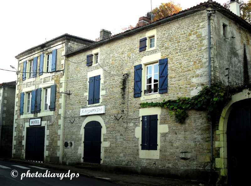
The hotel and restaurant on the main road through the village. This forms quite a busy route for lorries, as the road takes non-motorway traffic, following the river's course, west to east across the area. On the chilly but dry November day we visited, all downstairs shutters were closed up, as you can see! Many such businesses shut down for holidays before Christmas and this could be the reason for the lack of activity.

Almost next door is the Mairie, presumably closed for lunch! A grand building for a relatively small village of 500 or so inhabitants.

Just across the road, we saw this lovely fountain and water trough. Below and to the left in the picture, a little stream runs  downhill in a deep channel, away to the main river.

With my liking for mysterious windows and doors, I just couldn't resist this example, set in a huge stone block for some forgotten reason!!

Iron gates in unmistakable French style, but these need some TLC!

and last but certainly not least in  Cellefrouin part 1, the War Memorial. 

Part two to follow next week with more places of interest in the village.


P.S. I also have a daily photo dairy, sometimes interesting sometimes very boring!  http://photodiarydps.blogspot.fr/ 


See also - My Life Before Charente Updated 27/11/12